Port Babcock Rosyth
(Babcock International Group)
Geographical Position
56°.01 N 3°.2’W North side of the River Forth about 1 mile West of the Forth Road Bridge.
Access to the Non Tidal basin at Port Babcock is available through both a conventional lock and a single direct entrance which is restricted to high tide transits.
Maximum Vessel Dimensions :
Direct Entrance – LOA Unrestricted – Beam 39m Draft 9.4 metres
Entrance Lock – LOA 235 metres Beam 24 metres Draft 10.6 metres
Key features of the Port are
- Large Non Tidal Basin
- Berths 1340 metres Non Tidal Basin Drafts 9.9 to 11.4 metres
- 750 metres of River Berths 6.7 to 10.5 metres
- 100,000m2 Quayside storage
- 300 Acre Site.
- Mobile Cranes with capacity upto 500 tonnes are available.
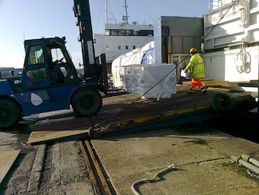
- Commercial Port Operations handle Dry Bulk – Break Bulk – Project and Heavy Lifts
- Working hours subject dependant on the contracted Stevedoring agreement.
- Full integrated cargo handling and transport systems available.
Air Draft restrictions apply for the Forth Rail and Road bridges normal allowable height above chart datum is 49.20m however if maintenance platforms are in place this will be reduced by further 2.7m. Any vessels which come near these restrictions must consult with Forth and Tay Navigation prior arrival.
Distance from Pilot Boarding Position, (No. 3. Fairway Buoy) to approach channel, East of Beamer Rock Lighthouse is approximately 11 miles. The approach channel, East of Beamer Rock Lighthouse, is maintained at a dredged depth of 8.30 metres below Admiralty chart datum.
Towage
Owned and operated by Forth Ports Plc. and based in Leith.
5 Voith Schneider tractor tugs. Bollard pull: 1 x 50 tonnes,1 x 30 tonnes, 2 x 19 tonnes, 1 x 12 tonnes.
Tugs use ship’s lines, vessel is met on passing under the Road Bridge. Prevailing wind is SW. Manoeuvring can be difficult during heavy weather or if wind shifts Easterly.
Supplies (Bunkers / FW / Stores / Repairs).
Bunkers - can be supplied using road cars. Prior agreement is required. Shipchandler, laundry, deck/engine repairs, nav aid repairs all available. Fresh Water – available ex quay.

© 2025 W. Knight Watson & Co. Ltd | Privacy Policy | Site Map | Web Design by Broxden


